Home
|Africa|
Gallia
|
Germania
|
Iberia
|
Illyria
|
Italia
|
Language
|
References
©1997-2004 B M Walker
La Rochelle
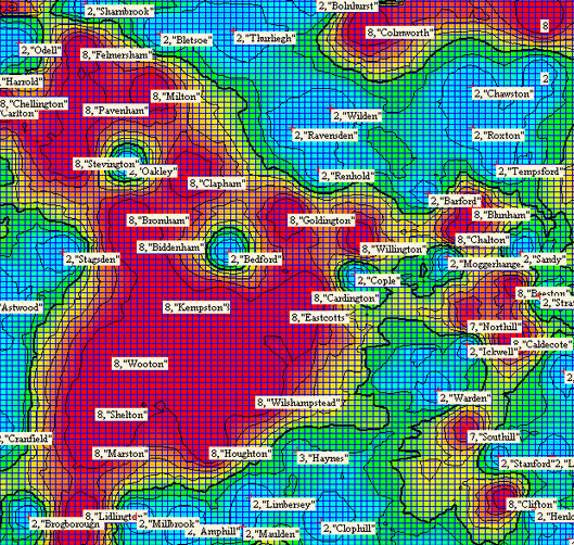
Mid Bedfordshire settlement (O.S. sheet 153)
Areas in red indicate habitation names. Blue areas are named after natural features. Green indicates the transition between the two and is introduced here artificially to improve the visual effect.
The area has many indications of Celtic transmission and early Saxon settlement. The large pagan inhumation cemetery at Kempston produced very early Saxon cruciform brooches. Biddenham has a Celtic ritual shaft. The local river name may have survived in the name Kempston. Clapham may contain the Celtic root "clop"- stone outcrop.
A battle against the British is recorded at Bedford.
Bedford is of course not an original settlement site but simply the ford of Bieda who settled at Biddenham (Biedanham).