Home
|
Africa
|Britannia
|
Germania
|
Iberia
|
Illyria
|
Italia
|
Language
|
References
|©1997-2004 B M Walker
La Rochelle
Survival of the Civitates
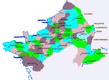
There is a fairly close fit of the area shown to the three fifth century Roman military districts covering Belgium and northern France.  In the north was Gallia Secunda and Germania Secunda with, to the west, the Tractus Armoricanus et Nervicanus, the Dux Mogontiacensis holding the middle Rhine with the Dux Sequanici on the upper Rhine. That the Germanic invasions and settlements had very little influence on the names of major centres is obvious.